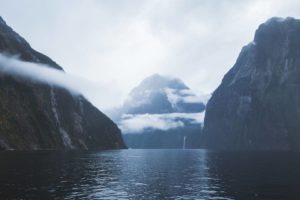
Hiking Rob Roy’s Glacier Track
We road tripped around New Zealand’s South Island for just over two weeks. While we only covered about one-third of the island, I have to say that Wanaka was probably my favourite destination. One of the places that really made is stand out from the rest was the incredible Rob Roy’s Glacier Track.
A heads up, this hiking trail is located about 1.5 hours out of town, a bit of a mission, but definitely worth the effort.
Now, Wanaka is a destination synonymous with hiking. The most iconic hike in the region is Roy’s Peak Track. This trail leads travellers up a steep mountain to a lookout with epic views across Lake Wanaka.
As most travellers are so eager to climb Roy’s Peak for their Instagram shots, Rob Roy’s Glacier Track often gets overlooked. It is only thanks to the guy working at the reception of Wanaka Lakeview Holiday Park (one of our campsites in Wanaka), that I was even made aware of Rob Roy’s Glacier!
So, where is Rob Roy’s Glacier Track?
As I mentioned, Rob Roy’s Glacier Track is located about 1.5 hours (54 km) out of Wanaka. So, it’s not even Wanaka anymore. In fact, it’s quicker to drive to Queenstown!
The track is in the Mount Aspiring National Park, to the north-west of Wanaka. The road that leads there is one way in and out, so it’s a bit of a commitment heading all the way out there.
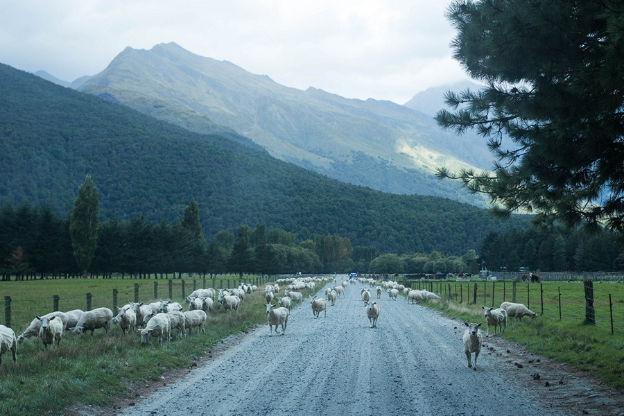
To reach the trail you need to follow the Wanaka-Mount Aspiring Road around to the west of Lake Wanaka. You’ll pass the small village at Glendhu Bay along the way, then you know you’re heading in the right direction.
The 54 km road to Rob Roy’s Glacier Track is only sealed for the first 24 km. The remaining 30 km is unsealed at best. The further you head into the national park, the worse the road condition gets, with some section being totally washed out or even underwater.
They suggest this road isn’t suitable for rental campervans, but we and many others have been the whole way regardless. Proceed with caution is all I will say.
Hiking Up to the Glacier
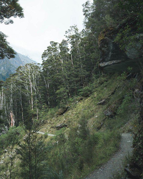
The trail is a total of 10 km long, takes about 4-5 hours return, hiking up and down the same track. Though there are some semi-steep sections, the track is relatively easy. The track is well trodden, however, it is still not suitable for prams or wheelchairs, etc…
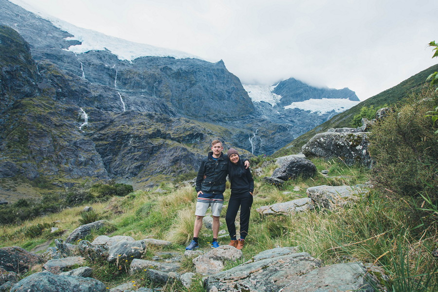
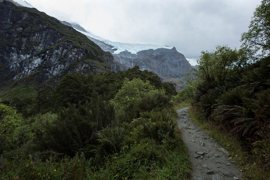
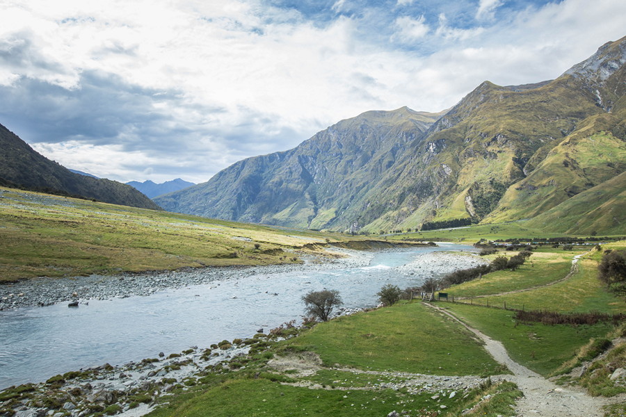
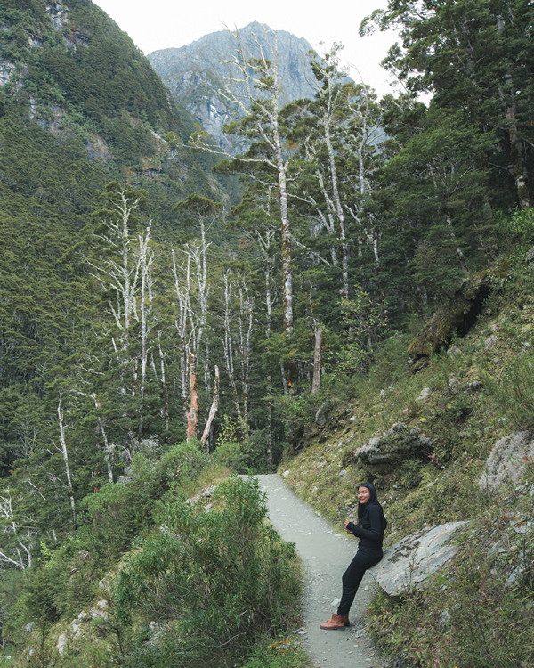
The track starts at the Raspberry Creek Carpark. First, you will walk through private farmland for about 10 minutes. Then, you will cross the Matukituki River into the Mount Aspiring National Park by a rope swing bridge, after which you’ll be following the trail through the forest and up to the glaciers.
There are two stages to the hike; the lower lookout, and the upper lookout.
The lower lookout offers a nice view of Rob Roy’s Glacier through the forest, albeit a bit far away. It takes about 1 hour to reach the lower lookout from the start of the trail.
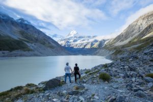
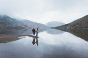
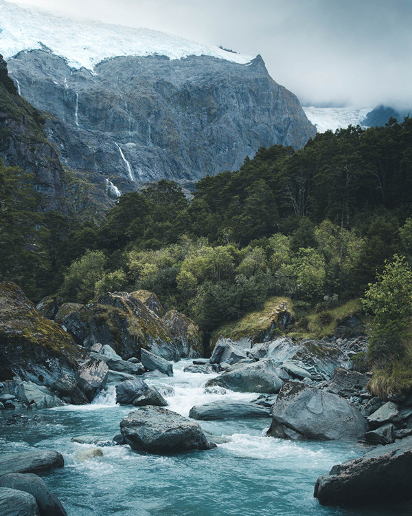
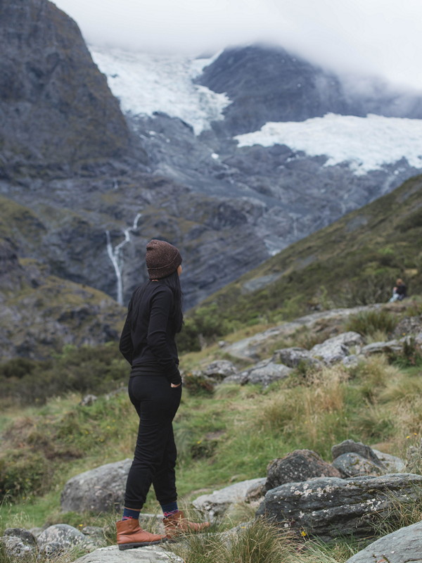
The upper lookout at the end of the trail is where the real magic happens. I highly suggest you make it here regardless of your fitness level. The upper lookout is surrounded by a stunning landscape of 300-meter tall mountains capped with glaciers, waterfalls pouring off the edge down into the thick forest below. It takes about 2 hours to reach the upper lookout from the start of the trail, a bit longer of course if you’re taking lots of photos like me.
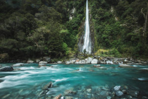
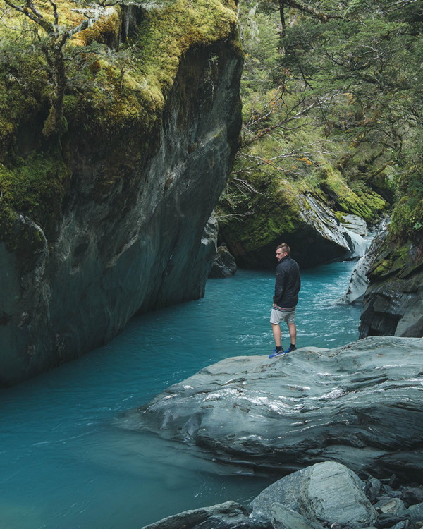
Along the way, you will hike through the temperate forest where you may be lucky enough to spot some native parrots and finches rustling about in the trees. The trail follows a stream which flows directly from the glaciers down to the Matukituki River where the hike started. There are some scenic spots along the way where you can stop by the river.
[one_half]
[/one_half]
[one_half_last]
[/one_half_last]
[one_half]
[/one_half]
[one_half_last]
[/one_half_last]
[one_half]
[/one_half]
[one_half_last]

[/one_half_last]
Know Before You Go
- The road between Wanaka and Rob Roy’s Glacier Trail can be washed out and impassable at times. If it’s been raining heavily, check the route with the locals first.
- The alpine weather can change quite quickly, so pack appropriate clothing. I suggest a warm jacket and a waterproof cover in case it decides to rain.
- Avalanches can close the trail between May to November. Check the current status with the Department of Conservation Office in Wanaka.
- The start of the track from the carpark to the swing bridge crosses private land, so be respectful and stick to the trail.
Suggested Packing
- Waterproof jacket in the likely case that it rains
- Hiking boots which will prevent an ankle roll
- A warm jacket, the weather turns quick
- A decent torch in case you end up hiking back at night
- Lunch, or at least some snacks
- 5 litres of water per person
- As much photography gear as you can carry
Where to Stay in Wanaka
We travelled around New Zealand by campervan, so naturally spent most of the time in holiday parks or national park campsites around New Zealand. We stayed in two different holiday parks around Wanaka:
Glendhu Bay Motor Camp, located about 20 minutes west of Wanaka towards the Mount Aspiring National Park. Unpowered campsites are located right next to the water of Lake Wanaka. Powered campsites are located about 100 meters back off the water.
Wanaka Lakeview Holiday Park, located right in the heart of Wanaka. Despite the name, you don’t really get a view of the lake, however, you will be close enough to walk to the pubs and restaurants along the main strip.
Planning a road trip around New Zealand? Check out my two week New Zealand South Island itinerary. This route will take you on a loop from Christchurch, across the mountains to the west coast, south to Te Anau via Wanaka and Queenstown, then north back up to Christchurch circling Mount Cook. It’s the exact loop I drove and would do it again!
Other Awesome Experiences in NZ